We have been enjoying Albuquerque so much that we signed on for a second week at our extended stay hotel here. Staying for 2 whole weeks at one location will be a first since leaving Oakton in December!
The fact that it is an abnormally early spring this year has probably helped promote our positive impression of the area. It's taken a bit of adjustment for me to cope with the chilly morning temperatures, but it doesn't take long for the sun to warm things up. Only one day since we have been here could be called a cloudy day and those clouds didn't stay around very long. At times we have had to cope with strong winds, for example, on our Sunday afternoon bike ride.
Our hotel is a block from the Tramway Bike Path and we thought an enjoyable Sunday afternoon activity would be to ride out and back and enjoy the views of the Rio Grande valley to the west and the Sandia Mountains to the east. We are on the south end of the path and the 9 mile ride to the ending point at the north was quite pleasant. But turning around we were in for a surprise. The wind had picked up considerably and it was blowing quite strong from the south. It was a good workout getting back to our hotel.
We learned a lesson from our Tramway Bike Path experience and used the prevailing winds to our advantage the next time we did a bike ride. That ride was on the Paseo del Bosque Bike Trail, which basically parallels the Tramway Bike Path, but is west of the city along the Rio Grande. We started on the north end of that trail so that by the time we turned around in the afternoon to head back north, the south winds were tailwinds, instead of headwinds.
On the Paseo del Bosque Bike Trail.
Besides bike riding, we have also taken several walks in surrounding desert areas. We wanted to visit Petroglyph National Monument, but to get the full picture of the history and geology of this area it required making two separate visits. One visit was to the western boundary of the monument to walk through the area known locally as the Albuquerque Volcanoes.
Volcanic formations at Petroglyph National Monument.
These formations are what's left of the "fissure" volcanoes where the magma that rises up comes from cracks or fissures in the earth rather than through a central vertical vent. The volcanic activity here created the boulder-strewn escarpments that were used by American Indians and Spanish settlers as backgrounds for more than 20,000 petroglyphs.
View from path around 3 volcanoes looking east towards Albuquerque. The basalt escarpments are barely visible from here as the black cliffs in the middle of the photo.
View of cinder cone remnants on side of Vulcan Volcano, the third one on the loop trail.
To see the petroglyphs and walk through the escarpments was another visit to the monument.
On the trail to the escarpments to view petroglyphs
We had to look closely up the piles of boulders to see petroglyphs. I'm sure there were many that we overlooked.
Dancer?
Coyote?
An example of some of the desert blooms. It doesn't seem possible that anything could bloom in such dry soil.
Today's adventure was to ride the Sandia Peak Tramway from its start at the northeastern edge of the city to the crest of the Sandia Mountains. On a couple of our other excursions around the foothills we had been able to catch glimpses of the tramline and support towers and once or twice a tiny tram car creeping its way up the incline. So it was fun today to actually be there and find out what it was all about.
A tram car going the opposite direction of our car.
We had been warned to dress warmly as it can be quite cold and windy at the top. We were fortunate that the winds today were not strong, although I was glad to have my jacket and a couple of extra layers of clothes.
Once at the top, there are great views looking westward toward the city, as well as eastward on the other side of the crest where it's possible to see Santa Fe and other mountains in the distance. Lee's cousin, who has lived in Albuquerque for many years, acted as our tour guide, pointing out landmarks in the city and valley below.
The other side of the crest has a ski area, which only recently closed for the season. The leftover snow on the slopes and the chair lift for the ski area.
It's nice to have a 10,000 foot view of the city but I was more than ready after an hour or so in the cool mountain air to ride back down the mountain and enjoy the desert warmth and sun for the rest of the day. I look forward to another week here as we continue to explore the area and soak up the sunshine.
A way to let friends and family follow along on our adventures of travel, hiking and biking.
Wednesday, March 28, 2012
Friday, March 23, 2012
Warm Weather and Sunshine, at Last!
It didn't look promising Monday morning when we crossed the border of Texas and arrived in New Mexico.
Having lived for 20 years in New Mexico, I had fond memories of the warm weather and 300+ days of sunshine a year. In New Mexico I knew that we wouldn't experience a solid week of gray, overcast skies like what we had left behind in Austin. But what I hadn't counted on was that March in New Mexico can bring windstorms with cold and blowing dust and that's just what awaited us. A late winter snowstorm had moved through Arizona on Sunday and the effects of the cold and wind were evident, even down in the southern part of New Mexico. Fortunately, it didn't take too long for the weather to warm back up and today was a perfect 70 degrees, no clouds and no wind.
Our first stop Monday in New Mexico was in the city of Las Cruces. We visited the Mesilla Valley Bosque State Park for the opportunity to walk along the Rio Grande River. Sadly, there was very little water in the river.
Rio Grande River at Mesilla Valley Bosque State Park
I don't remember ever having seen the river that dry. The Rio Grande is the continent's second largest river and plays a vital role in transforming barren desert into fertile land for farming. The Ganges River of India is the only river in the world that is more heavily used for irrigation.
As we continued our drive northward in New Mexico from Las Cruces the route basically paralleled the river. The further north we went the more I began to understand that all was not lost, as far as what had seemed to be a dried up river. The key is the management of what water there is by regulating how much is allowed to flow from the source in the Colorado mountains to the mouth in the Gulf of Mexico 1,885 miles away. There is snow yet to melt in the mountains and, hopefully, there is enough snowmelt that when the floodgates are opened at Elephant Butte Dam the dried up places we looked at downstream will again have water.
In Albuquerque, where we arrived on Wednesday, we were happy to see that there is a lot more water in the river. We were told that things are more dry than normal, but it did look a lot better when we walked along the river at the Rio Grande Valley State Park.
Rio Grande River at Rio Grande Valley State Park in Albuquerque
Bosque Trail at Rio Grande State Park. A bosque is a clump or grove of trees like the ones here.
Spring is only beginning here in Albuquerque. We've seen forsythia, redbud and bradford pear trees blossoming, but trees like the cottonwoods here don't yet show any signs of green.
We are staying in the Albuquerque area for the next two weeks and are excited about the opportunities for activities that we enjoy. We have a bike map of the city and there are a number of good trails to explore. There are also many hiking trails in the Sandia Mountains just east of the city. Today's perfect weather gave us the opportunity to do a short hike in the foothills of the Sandias and then later in the day a bike ride on one of the city trails.
Hike in Sandia foothills
Our hotel is on Central Avenue, which once was part of the famous cross country highway Route 66. When we are in the mood for some nightlife we need to follow it back down towards the city and check out the historic vintage neon signs that they say still are there along the route.
The journey continues.
Sunday, March 18, 2012
Leaving Austin
We enjoyed our week stopover in Austin, but checked out of the hotel Saturday and continued our westward progress across Texas. A couple of days before we left Austin, we spent an afternoon sightseeing in nearby San Antonio. After all, one wouldn't want to leave this part of Texas without a visit to the Alamo.
Besides seeing the Alamo, San Antonio's famous River Walk is another must see. We checked out restaurants and shops there, selecting a Mexican restaurant as our lunch stop, where my lunch was a plate of delicious tamales.
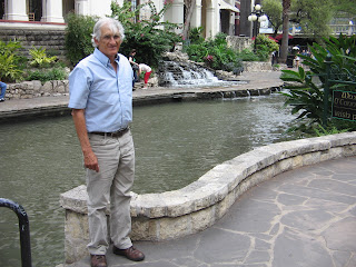
Along the River Walk in downtown San Antonio
Nueva Bridge dam. Several dams, locks and a flood control tunnel have been built in the San Antonio River Walk area over the years to control the amount of water flowing in the River Walk area.
River Walk downstream from Nueva Bridge dam on the way to King William Historic District.
Hemisfair Park with Tower of Americas in background. The park was built when San Antonio hosted the World's Fair in 1968.
Saturday as we drove west and north out of Austin, our goal was the city of San Angelo. This took us through the heart of what is known as Texas Hill Country. One of the attractions in this area each spring is the abundance of wildflowers that grow along the roadsides. On one of our bike rides in Austin I had enjoyed the beauties of bluebonnets in blossom along the bike trail. But I had no idea what was in store for us on our drive through "The Bluebonnet Capital of Texas." I have never seen so many wildflowers in my life. I kept thinking each place along the road was the best so far and I just had to tell Lee to stop there so I could get one more photo. Of course, it seemed every time I wanted to stop there was a pickup truck or car right behind us. To prevent a traffic accident we had to wait for another opportunity. As the day progressed we began to see that we weren't the only ones who were stopped along the road at various places out in a patch of flowers trying to get a good picture. There was just no way to capture all of it but here are a select few.
Roadside Bluebonnets
Winecup with Bluebonnets
Indian Blanket Flower with Bluebonnets
White Prickly Poppy with Bluebonnets
The springtime spectacular that we got to enjoy on our drive to San Angelo was a sharp contrast to our "sightseeing" in San Angelo. We had looked at a map and knew that there were a couple of lakes in the area, the Concho River that flowed through town, and a reservoir outside of town with a state park. We made plans to camp at the state park. What we hadn't realized was that this part of Texas has not recovered from several years of severe drought conditions. The reservoir at the state park has shrunken to about 1% of it's original size. The dam that created the reservoir is huge and hovers over the whole state park but there is no water for the dam to control. Ironically, it had been built after a 1936 flood that washed away homes and businesses on both sides of the river. It was completed in 1952 at the latter part of a seven-year drought. Scoffers joked about building a big lake in a place where it never rained. The first and last time that the lake filled was in 1957, after a tropical depression stuck over Texas, caused statewide flooding. Sadly, its current state of dryness is not the first time that it has dried out.
Climbing the side of the dam at San Angelo
View from the top of the dam
Making the descent from the dam
The other unforeseen circumstance in our San Angelo campout was the open barrenness of the tent camping area combined with last night's strong spring winds.
Our poor tent whipped and flapped all night long as it was battered by the winds that gusted continually. In dismantling the tent in the morning we weren't fast enough after we pulled up the stakes and a gust of wind grabbed it, tumbled it over and one of our tent poles snapped. Before we left town we found an outdoor store where we bought a tent pole repair kit. But we knew we wouldn't be camping tonight. We are in a hotel room in Fort Stockton, Texas. Lee spent a good part of the evening working on repairs, and depending on tomorrow's weather, we may get to try out his repair job by attempting another campout.
Tuesday, March 13, 2012
Texas Travels
Friday was a milestone day, as we left Baton Rouge, heading west, we crossed over the Mississippi River. It's a big step in our travels to the West to now realize that we have left the east behind us. We opted for a route that avoided Interstate 10, instead going north into Louisiana to Alexandria, then east into Texas spending the night in Huntsville, Texas.
There were a lot of interesting parks and forests along the way that we would have liked to investigate, but with unending rain and highs barely reaching 50 degrees, the only place I wanted to be was warm and dry in the car.
Saturday was another cold, rainy day. We spent just enough time in the morning before leaving Huntsville to check out the town's famous statue to Sam Houston.
Our goal for Saturday was to reach Austin, Texas, where we had plans for making a one-week stop over. Our previous experiences with one-week stays had lulled us into thinking that we could just show up in a town that had a Value Place hotel and easily find a room for the week. It sure didn't work that way in Austin. Everything was booked up, it was pouring rain so you could hardly see to drive and the unfamiliar highways had us driving in circles. What we hadn't realized was that March 9-18 tens of thousands of people from all over the world show up for Austin's South by Southwest Music Conference and Festival (SXSW).
We finally found a place in the town of Round Rock, north of Austin. Sunday afternoon the skies cleared, giving us the opportunity the last couple of days to see some of the sights in the area.
Round Rock has an interesting history from the days when the West was being settled. Its name was derived from the table-shaped stone in the middle of Brushy Creek. Indians and early settlers used the stone as a guide that marked an important low-water wagon crossing. Round Rock was a part of the Chisholm Trail on the route from deep in the south of Texas to cattle markets in Hays, Kansas. Numerous cattle drives, with thousands of longhorns in the herds, passed through Round Rock during the post Civil War period.
Round, table-shaped stone in the middle of Brushy Creek that gave Round Rock its name
Round Rock City Park dedicated to Chisholm Trail and early pioneers. Hattie Clark was the first woman to travel the Chisholm Trail (1871).
We have taken a couple of drives from our hotel in Round Rock into the downtown area of Austin. We played tourist at the Texas Capitol one day and rode our bikes on the Town Lake Hike and Bike trail another day.
Texas State Capitol
Pedestrian Bridge across Colorado River in downtown Austin.
Town Lake Hike & Bike Trail
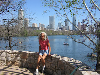
Overlook on Town Lake Hike & Bike Trail
There are also a couple of other bike trails in the surrounding communities that we investigated.
Texas bluebonnets (state flower) in bloom along Brushy Creek trail.
The weather is quite unpredictable so we are trying to balance the outdoor activities with other things. There certainly is a lot going on and we won't be bored in our time here.
Thursday, March 8, 2012
Louisiana Lingo
Looking at maps and brochures of Louisiana, as we plan our activities here, one of the things we learned is that the state has its own distinct lingo. You don't cross boundaries from one county to another--counties are called parishes. Sometimes you do cross rivers, but other times when you think it's a river it's actually called a bayou.
St. Tammany Parish, where we spent the first part of the week, has an interesting historical footnote. It was one of the Spanish-governed West Florida parishes that was not included in the Lousiana Purchase of 1803. In September 1810, residents revolted against Spanish rule and created the Republic of West Florida. The republic lasted 74 days, raising a new flag and electing a president, before being forcibly annexed by the US in December 1810.
Unlike the days that we had spent along the Gulf Coast in Florida, Alabama and Mississippi, the weather this week promised sunny skies, giving us the opportunity to spend some time camping.
For two days we were at Fairview Riverside State Park on the banks of the Tchefuncte River. The nights were quite cold, but since the days were sunny, we enjoyed being able to move our camp chairs to a sunny spot after breakfast and warm ourselves up before beginning the day's activities.
Boardwalk at Fairview Riverside
Tchefuncte River at Fairview Riverside
Fairview was a small park, but was a good base camp for doing other activities in the area.
We rode our bikes on the Tammany Trace bike path, doing a north section one day and a south section a second day. The trailhead in the town of Covington has a small park which felt like being in a small Iowa town for RAGBRAI.
Leaving Covington and crossing Bogue Falaya River
The Trailhead after Covington is another small town, Abita Springs. A pavilion here had a statue and plaque dedicated to the Legend of the Abita Princess.
Words on the plaque:
"Many years ago a dying Choctaw princess was brought to drink from a natural spring flowing from a cypress stump and then fully recovered. The healing properties of the Abita Springs have been famous ever since, as Abita Springs remains a favorite destination for those seeking the cool, pure waters and the ozone air of this very special place."
Cherokee Rose in bloom along Tammany Trace
At the Bayou Lacombe Trailhead on the Tammany Trace. This was an interesting stop because the bridge that the bike path crossed was actually a drawbridge--can you believe it, constructing a drawbridge just for a bike path?
Another two days of camping was spent at Tickfaw State Park. Whereas Fairview Riverside was close to an urban area, Tickfaw was way out in the swamps. We were a bit apprehensive about going there because of posted warnings that some of the tent sites were under water. It certainly was a wet area and we had to carefully look at all the sites to find one that wasn't too muddy or too far from the bathrooms. The first night only one other tent site had campers and the second night we were the only ones in the tent camping area. But it was quiet and peaceful and as long as I didn't let my mind wander to thoughts of something from the swamp crawling up into the tent at night, it was fine.
Campsite at Tickfaw (it looked better when the tent was set up)
Roadside view driving through Tickfaw
River Trail at Tickfaw
Boardwalk Trail at Tickfaw
Tickfaw was the base camp for our excursion yesterday into the Big Easy. We couldn't be this close to New Orleans and not take one day to play tourist.
Jackson Square in New Orleans
Lunch stop in courtyard of a small eatery on Bourbon Street
Street musicians
Tonight we are in a motel in Baton Rouge. The weather forecast calls for rain tomorrow so we decided to forgo another day of camping. We now have to decide whether to head west on Interstate 10 into Texas or to go further north exploring other parts of Louisiana before driving into Texas.
St. Tammany Parish, where we spent the first part of the week, has an interesting historical footnote. It was one of the Spanish-governed West Florida parishes that was not included in the Lousiana Purchase of 1803. In September 1810, residents revolted against Spanish rule and created the Republic of West Florida. The republic lasted 74 days, raising a new flag and electing a president, before being forcibly annexed by the US in December 1810.
Unlike the days that we had spent along the Gulf Coast in Florida, Alabama and Mississippi, the weather this week promised sunny skies, giving us the opportunity to spend some time camping.
For two days we were at Fairview Riverside State Park on the banks of the Tchefuncte River. The nights were quite cold, but since the days were sunny, we enjoyed being able to move our camp chairs to a sunny spot after breakfast and warm ourselves up before beginning the day's activities.
Boardwalk at Fairview Riverside
Tchefuncte River at Fairview Riverside
Fairview was a small park, but was a good base camp for doing other activities in the area.
We rode our bikes on the Tammany Trace bike path, doing a north section one day and a south section a second day. The trailhead in the town of Covington has a small park which felt like being in a small Iowa town for RAGBRAI.
Leaving Covington and crossing Bogue Falaya River
The Trailhead after Covington is another small town, Abita Springs. A pavilion here had a statue and plaque dedicated to the Legend of the Abita Princess.
Words on the plaque:
"Many years ago a dying Choctaw princess was brought to drink from a natural spring flowing from a cypress stump and then fully recovered. The healing properties of the Abita Springs have been famous ever since, as Abita Springs remains a favorite destination for those seeking the cool, pure waters and the ozone air of this very special place."
Cherokee Rose in bloom along Tammany Trace
At the Bayou Lacombe Trailhead on the Tammany Trace. This was an interesting stop because the bridge that the bike path crossed was actually a drawbridge--can you believe it, constructing a drawbridge just for a bike path?
Another two days of camping was spent at Tickfaw State Park. Whereas Fairview Riverside was close to an urban area, Tickfaw was way out in the swamps. We were a bit apprehensive about going there because of posted warnings that some of the tent sites were under water. It certainly was a wet area and we had to carefully look at all the sites to find one that wasn't too muddy or too far from the bathrooms. The first night only one other tent site had campers and the second night we were the only ones in the tent camping area. But it was quiet and peaceful and as long as I didn't let my mind wander to thoughts of something from the swamp crawling up into the tent at night, it was fine.
Campsite at Tickfaw (it looked better when the tent was set up)
Roadside view driving through Tickfaw
River Trail at Tickfaw
Boardwalk Trail at Tickfaw
Tickfaw was the base camp for our excursion yesterday into the Big Easy. We couldn't be this close to New Orleans and not take one day to play tourist.
Jackson Square in New Orleans
Lunch stop in courtyard of a small eatery on Bourbon Street
Street musicians
Tonight we are in a motel in Baton Rouge. The weather forecast calls for rain tomorrow so we decided to forgo another day of camping. We now have to decide whether to head west on Interstate 10 into Texas or to go further north exploring other parts of Louisiana before driving into Texas.
Subscribe to:
Posts (Atom)